About MyGPSWaypoints
MyGPSWaypoints captures exact coordinates in the field and helps you navigate right to them. Whether you're overlanding, running a rally stage, hiking, hunting, or exploring by 4x4, it turns the places that matter into precise, organized waypoints you can always come back to.
Log your live position with one tap, name and classify it, stamp the location data onto a photo, and follow a live compass straight to your target. Import and export GPX to work with your other GPS tools, and back up your entire library — waypoints and photos — as a single file.
No account required. Your waypoints and photos stay on your device. Get out there, and always find your way back.
Screenshots
Key Features
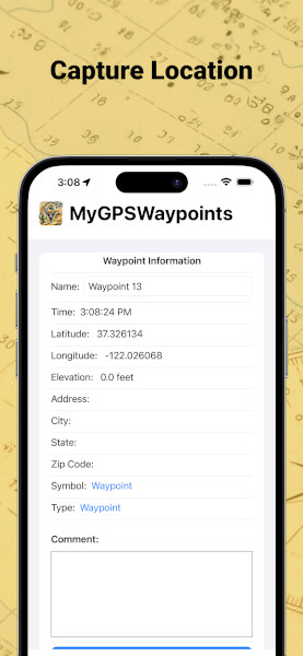
- Capture Waypoints — Log your live GPS position with one tap, automatically reverse-geocoded to a street address.
- Name & Classify — Tag each waypoint with 30+ symbols and 17 activity types, plus elevation, coordinates, and field notes.
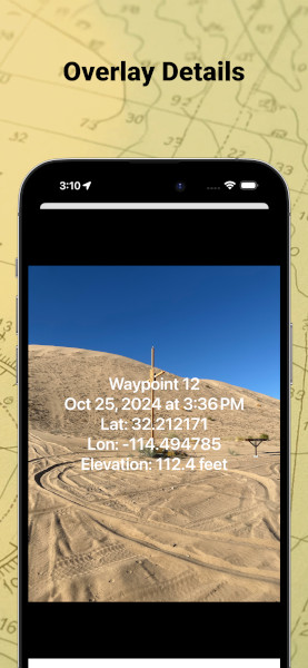
- Data-Stamped Photos — Burn location data onto your photos: name, date, coordinates, elevation, address, and notes.
- Customizable Overlays — Choose which fields appear, the position, alignment, text size, and colors, with light or dark styling — re-edit and re-share anytime.
- Interactive Map — Standard, hybrid, and satellite views with all of your waypoints pinned in place.
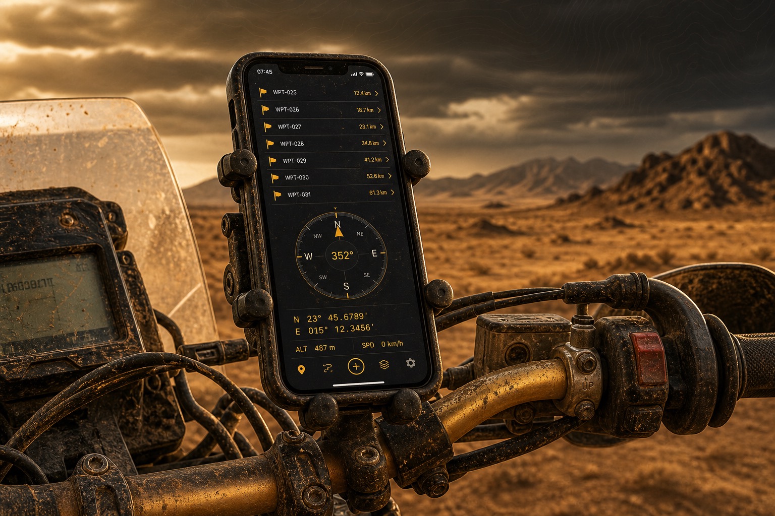
- Live Compass & Bearing — An orientation-aware heading and navigation arrow with real-time distance and bearing to any target.
- Telemetry Readout — GPS status, coordinates, elevation, distance, and heading that expands or minimizes to keep the map clear.
- Navigate Anywhere — Jump to a waypoint in Apple Maps, or head straight for it on the in-app map.
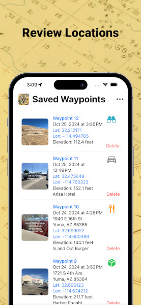
- Organized Library — Browse everything with photo thumbnails; edit details, toggle map visibility, and share a photo or location.
- GPX Import & Export — Move waypoints between MyGPSWaypoints and your other GPS tools and devices.
- Backup & Restore — Save and restore your entire library — waypoints and photos — as a single file.
- Private by Design — No account required. Your waypoints and photos stay on your device.
Made Your Way
App Information
Available on the App Store iOS
Privacy: Your waypoints and photos stay on your device. Nothing is shared unless you choose to export, back up, or share it.
Location: MyGPSWaypoints uses your location to capture waypoints, show your position on the map, and drive the live compass, heading, distance, and bearing readouts.
Feature requests: Have an idea? Submit and vote on features to help shape where MyGPSWaypoints goes next.